Part 2: The Geology and Archaeology
 The history of Croham Valley extends back around ninety million years, that being the approximate age of the chalk and its contained fossils of marine animals underlying so many of our gardens.
However, we have no continuous record, as there are two huge gaps of 25 million years and 40 million years in the local geologicalrecord, What was happening locally during those long periods can only be interpreted from rock beds preserved elsewhere, as far away as Denmark or beyond.
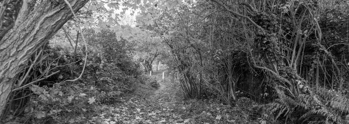
The three rock beds forming Croham Hurst (Chalk, Thanet Sand, and Blackheath Pebbles) are not horizontal, but slope downwards at a small angle towards the northwest. This can best be appreciated by looking in that direction from the east end of the western open heathland area on the summit ridge, where the ground formed on the surface of the pebble beds slopes in that direction. The highest level at which the Chalk outcrops can be followed by walking along the bridleway along the northern edge of the woodland from the Bankside end to the far end of the golf course. The chalk bed is found progressively higher towards the south-east.
The beds of Blackheath Pebbles, Thanet Sand, and Chalk were deposited on horizontal sea floors, and were continuous from Croham Hurst across the valley to Ballards. Millions of tons of these rocks have been eroded away to form Croham Valley, which probably achieved its current valley form by or during the Ice Age in the last two million years or so.
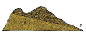
Although the highest parts of the hill are largely very pebbly ground, this is not a relic of an ancient shore-line and beach. Croham Hurst was never an island! These very rounded flint pebbles are a fragment of an extensive bed of pebbles deposited in deep sea-water around 57-58 million years ago. Other parts of the same deposit are on the tops of Addington Hills, and Hayes and Keston Commons, Blackheath in southeast London, Charlton, and other places in north Kent. These beds get their name from the locality near Greenwich where they were first described and studied by geologists. Near the pathway leading eastwards from the eastern open heathland on the summit ridge can be found a mass of naturally cemented pebbles, this being colloquially called ‘pudding-stone’ or, by geologists, a conglomerate. The natural cement holding the pebbles together is mostly a more or less hydrated iron oxide (chemically much the same as rust) containing also some sand. The iron oxide probably came from dissolved iron compounds from younger beds of clay which
once lay above the pebble beds. This hard cemented conglomerate appears to underlie the whole summit ridge of Croham Hurst, as lumps of it can be found towards the bottom of the steep slopes down towards Upper Selsdon Road. The conglomerate layer is probably the reason for Croham Hurst surviving as an isolated hill or geological ‘outlier’ completely surrounded by sandy and chalky lower land.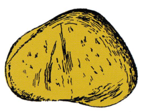 The middle layer of rock beds forming Croham Hurst is the Thanet Sand (named after the Isle of Thanet in north-east Kent where geologists first studied it). The sand forms the fairly steep slopes down from the summit ridge, and is most visible from the steps leading down Breakneck Hill towards Upper Selsdon Road, where from time to time heavy rainfall has washed some of it away, leaving several trees ‘standing on their roots. The name ‘Breakneck Hill’ has appeared on maps since at least as early as 1877, but there seems to have been no record found of when and why this name was adopted.
As pebbles roll down hill at any opportunity, and sand is easily washed downhill by heavy rainfall, many tons of these materials now cover the sandy and chalky lower slopes. This erosion was probably especially rapid during the last Ice Age, when Croydon’s landscape, climate and vegetation resembled those of northern Siberia! Glaciers once covered England about as far south as
Chelmsford and St. Albans. The soils on Croham Hurst alternately froze and thawed during colder and sunnier weather and, well lubricated with water from melted ice, slumped or flowed down the slopes. Two shallow disused sand pits have been dug at some time near Bankside, but when and
for what purpose is not known. They appear to pre-date the first Croham Hurst nine-hole golf course, which was on the land occupied by the Old Whitgiftians’ playing fields, so were not exclusively dug for sand for bunkers.
Along the northern edge of the summit ridge, and in places down the slopes towards Bankside and the present golf course, there are numbers (over a dozen) of roughly circular pits which were once thought to be the relics of prehistoric huts. However, archaeological excavations in 1968 revealed no evidence that they were ever deliberately dug. Geologists today now interpret these pits as formed naturally as a result of chalk below the Thanet Sand being dissolved away by percolating mildly acidic rain-water. ‘There are similar pits in the same geological context nearby, such as at Addington Hills, and at Hayes Common. Exceptionally large ‘solution holes’ can be seen on the ridge leading northwards from the summit pine plantation, in the grounds of the Royal Russell School just beyond the back fence at Coombe Wood, and in land at Addington Hills alongside Oaks Road. When the old railway tunnel, now used by modern trams, was made under Park Hill in the early 1880s geologists recorded beds of clay and quicksand between the Thanet Sand and the overlying Blackheath Pebbles. These “Woolwich and Reading’ beds appear to be missing from Croham Hurst. Where the Chalk outcrops around the lower slopes of the hill some flints with dark green coatings on them can be found. These form the Bullhead Bed at the base of the Thanet Sand. Look for them where chalk had been exposed by trees being uprooted, or by badgers. The green mineral is called glauconite, an iron aluminium potassium silicate, and is very weakly radioactive on account of the potassium content. This is no significant hazard to human health (our own nervous system depends on potassium compounds in our bloodstream) but is useful in making dating possible. The lowest beds of Thanet Sand have been dated to about 60 million years ago. The Chalk immediately underneath is dated to about 85 million years, so around 25 million years’ worth of geological deposits are missing! Another 40 million years worth of sediments younger than the pebble beds are also missing. ‘Two shallow chalk pits, now overgrown and hardly recognizable, have been dug near Upper Selsdon Road at some unknown time, the excavated material perhaps being used as an agricultural soil conditioner on nearby fields on sandy soils. The higher parts of the Hurst, at least, have apparently never been cultivated, resulting in the survival of archaeological evidence. The most visible feature is the tumulus, or burial mound, near the pine plantation on the eastern open heathland. This was identified by Sanderstead resident and archaeologist Brian Kenneth Hope Taylor [1923-2001] in 1946 on the evidence of a crudely worked Bronze Age flint implement kicked out by a burrowing rabbit. The mound, a Scheduled Ancient Monument, has never been archaeologically excavated. It is most unlikely to contain any recognizable bones or metal artefacts on account of the very porous and acidic soil. Nearby in the open heathland local archaeologist Peter Ladson Drewett [1947-2013] and other members of the Croydon Natural History & Scientific Society identified traces of temporary huts during excavations in 1968. The huts were perhaps made by charcoal burners. The last most visible man-made features on the hill are several old Croydon parish boundary posts, bearing various dates from 1888 to 1920. The significance of the dates is not certainly known. The north-west corner of the Hurst was in the historic parish of Croydon, the remainder in Sanderstead. At least one of these posts (dated 1888) is now missing, but who dug it up, when, and where it is now are not known. Anybody wanting to detect less obvious features can hunt for the at least three surviving Ordnance Survey ‘revision points. ‘These are small roughly circular blobs of concrete with OS and a number and letter code inscribed on them. They mark precisely mapped reference point positions surveyed to the nearest ten centimetres and are shown on Ordnance Survey 50 inches to the mile plans published in the 1950s. They are not now used as when OS mapping is revised, as most revision now is done by aerial photography. Vanished former features have been an ornate, probably early 20th century drinking fountain, a pond, and public lavatories, all near the Bankside entrance. There was, also, once a corrugated iron hut for an on-site park keeper. This was near the West Hill entrance.
Reproduced from CVRA Spring 2017 Newsletter